The JUTC (Jamaica Urban
Transit Company) certainly is slow with the rollout of their AVL (Automatic
Vehicle Locator) as reported back in September 2014 in my blog article
entitled “JUTC's
AVL and Chaos on Back to School Day – How JUTC's Automatic Vehicle Locator may
placate Smartphone toting Commuters who ask Are we There Yet”, during the
chaos of the Smarter Card launch.
So much so that now a UWI Student's proposal has finally
seen the JUTC's information placed on Google Maps for Google Transit as reported in the article “JUTC
info on Google Transit, thanks to UWI student”, published Monday, August
24, 2015, The Jamaica Observer.
 |
The student is information technology consultant and
third-year computer science student at the UWI (University of the West Indies),
Oswald Smith, who had originally made the proposal to the JUTC as noted in the
article “JUTC on
Google Maps”, published Wednesday, August 26, 2015, The Jamaica Observer.
Thanks to this development, this means as of the week of
Monday May 11, 2015, you can now access the following information on GoogleTransit about the JUTC Buses:
1.
Routes
2.
Schedule
3.
Fare information
This means that Jamaicans toting around smartphones with
Google Maps can get this information on their phone without having to visit the
JUTC's rather smartphone unfriendly website
or call the HWT (Half-Way-Tree) Transport Center.
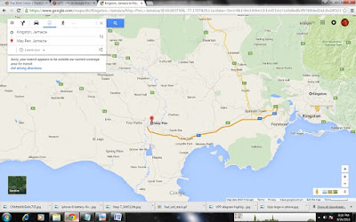
Google Transit, which is a sub-domain of the Google Maps that a default App found on most smartphones, supplies them with directions to take a JUTC bus from any point within the KMTR
(Kingston Metropolitan Transport Region).
It's not quite AVL as described in my blog article
entitled “JUTC's
AVL and Chaos on Back to School Day – How JUTC's Automatic Vehicle Locator may
placate Smartphone toting Commuters who ask Are we There Yet”, but it’s the
closest thing!!
So where did this idea originate?
UWI uploads JUTC
data to Google Transit – Why Google Maps is the next step towards an AVL
Apparently back in October 2013, a 28-y-o Oswald Smith, a
third year UWI Student in the Computer Science Department at UWI (University of
the West Indies) had submitted a proposal suggesting to the JUTC that they be allowed to upload the
information to Google Maps and make it available via Google Transit.
This would make it accessible to students with Laptops
smartphones and tablets, a very good idea, as I often use Google Maps myself to
find the location of strange locations in Kingston and what bus to take.
The JUTC was totally down
with the idea. And so the project commenced, with the JUTC providing the Routes, Schedule and Fare
information as well as GPS information for the bus routes and bus stops.
A Team in the Computer Science Department at UWI then
converted the data into the GTFS (General Transit Feed Specification) required
by Google Transit.
It must have been quite a mountain of data, as well as a lot
of rechecking to make sure it was accurately uploaded, but finally on Monday
May 11, 2015, the team achieved a clean upload of a clean GTFS feed to Google
Transit.
Now users of Google Maps can get accurate Route, Schedule
and Fare information for JUTC buses based on
their GPS location, first in Jamaica and the Caribbean. Its not complete, as
only 61 of 114 JUTC routes are available on Google as noted in the article “JUTC on
Google Maps”, published Wednesday, August 26, 2015, The Jamaica Observer.
So albeit not entirely accurate, it's a technical first in
the Caribbean and no doubt other Caribbean nations will follow. It's not quite
an AVL that tracks the location of buses, but at least you don't have to visit
the JUTC's websites or walk with the JUTC's schedule.
Here’s the link:
No comments:
Post a Comment
Please register and leave you comments. For contact, leave an email or phone number and I'll be sure to get back to you.